The landscape of Grumentumby Francesco Tarlano
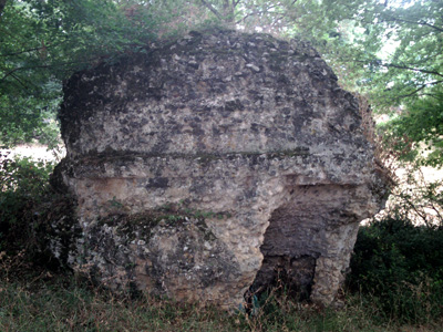
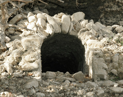
In addition to the monuments of the ancient city of Grumentum, in rural areas of the city Grumento Nova there are many archaeological evidence which contribute, together with other kind of sources, to the reconstruction of the ancient landscape of the Upper Agri Valley, to manage properly and enhance as only one large monument on which are stratified epochs and historical events, from the formation of the basin, as a result of the erosive and depositional processes of the main river, the Agri river and its tributaries, to the present day, through Oenotrian settlement phases, Lucan occupation, the Romanization of the area, the abandonment during late antiquity of settlements and infrastructure care, with the resulting formation of forests and swamps, until the control retrieval of the land by man with the genesis of the medieval villages which largely survive still today. Finally, other landmarks are visible in the territory of Grumento: two mausoleums of cylinder-type on a square base, one in locality San Giuseppe, the other in locality Bosco di Maglia, dated between the second and third centuries D.C., they can be visited and are still preserved quite well, despite the ruptures and subsequent reuses. In locality Traversiti, however, we can see the entrance of a burrow probably Roman, with a barrel vault roof, that can be interpreted as a hydraulic work, because it’s placed it just on the left bank of Agri river.
Copyright text and images (where there aren’t other references) by Francesco Tarlano.
|


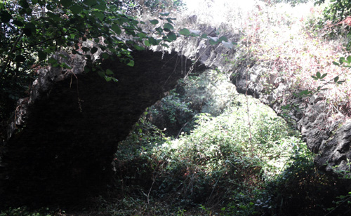 About the bridge nowadays we just have the archway soffit: between the shutter of the two arches exists a distance of 10 meters, while the distance from the keystone of the arch, lowered, to the ground is 3.30 meters. About the front now we still have, on both sides, only a few blocks, but they give us the possibility to measure the roadway, which, on the bridge, it was wide exactly 3 meters. The bridge sat on a bend of the river, which, over the years has cut the meander, so now it runs parallel to the structure, east-west oriented (as the remains of the road reaching the bridge). Analyzing the installation of the head blocks, we can see here that we have a kind of lowered arch, dating to the last two centuries of the republic. The bridge, located in a very characteristic area, spectacular from a naturalistic point of view, it’s still good to be visited today.
 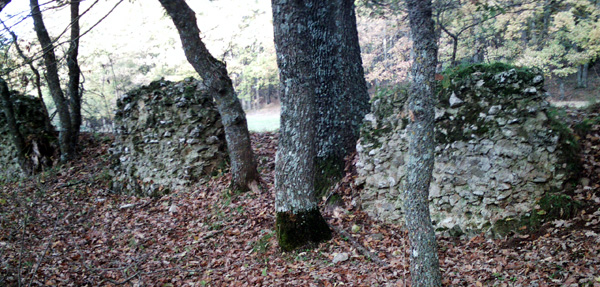 Another Roman infrastructure that is well enough preserved until today is the monumental aqueduct that served the ancient city: it collected the waters to the springs in locality Castagneto in Moliterno. Nowadays are still preserved various sections of the aqueduct. About 500 meters to east of the public road which from the Archaeological Museum of Upper Agri Valley heads to south, along the valley running to south of the city, designated by the IGM map with the toponym Spineta, are visible the ruins of the aqueduct arches, designated by the scholars of the eighteenth and nineteenth century with the name "Pilieri". These are the pillars of the arches on which were placed the aqueduct channels: the structures appear with regular intervals. For about 330 meters they can be followed very well: we can still see the remains of at least 51 wall complexes preserved in various formats.
 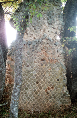 The exterior façade is in opus reticulatum, while for the internal filling were used stones not always of regular size, mixed with very consistent malt. For some of the wall fragments, at the base is possible to track the original external facing, in opus vittatum, with regular small blocks arranged in horizontal rows only at the corners, where it inserts the opus reticulatum present in the elevation. The height of the structures varies depending on the level of preservation: the best preserved wall complex measures approximately 4.5 meters in height, while in other cases are also visible fragments of walls just above the grass surface. The structures, in the points in which are present in succession, are located at a distance of 1.85 meters, so we should assume that this one was the light of the arches. The best preserved sections of walls, of which we can recognize their external limits, are long about 2.35 meters and tall about 0.90 meters. The work may be dated to the half of the first century B.C.
 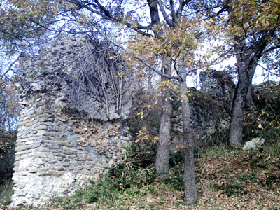 The same tract, interrupted by the passage of the modern public road, can be followed also within the archaeological area of Grumentum, about 100 meters to north-east from the St. Joseph chapel, where are preserved significant remains of the terminal part of the aqueduct that served the city, resting on the slope below the urban area. They reach a height of about 4 meters in the lower part of the slope, and then decrease in the upper part, in such a way as to let the channel stay always at the same altitude. The width of the structures is approximately 140 cm, in the places where it’s preserved the external facing of opus reticulatum; where it is collapsed, it’s possible to see the core of the wall, 105 cm wide, in opus rectangular, with blocks of uniform size, regularly arranged. In some points are clear, because of the malt, traces of a recent restoration of the internal opus of the wall. The opus is developed for about twenty meters, and reaches the plain at a point where is visible a big pile of rubble, which perhaps was meant to represent a point of water collection, probably the castellum aquae.